Earth Alerts monitors severe weather alerts worldwide
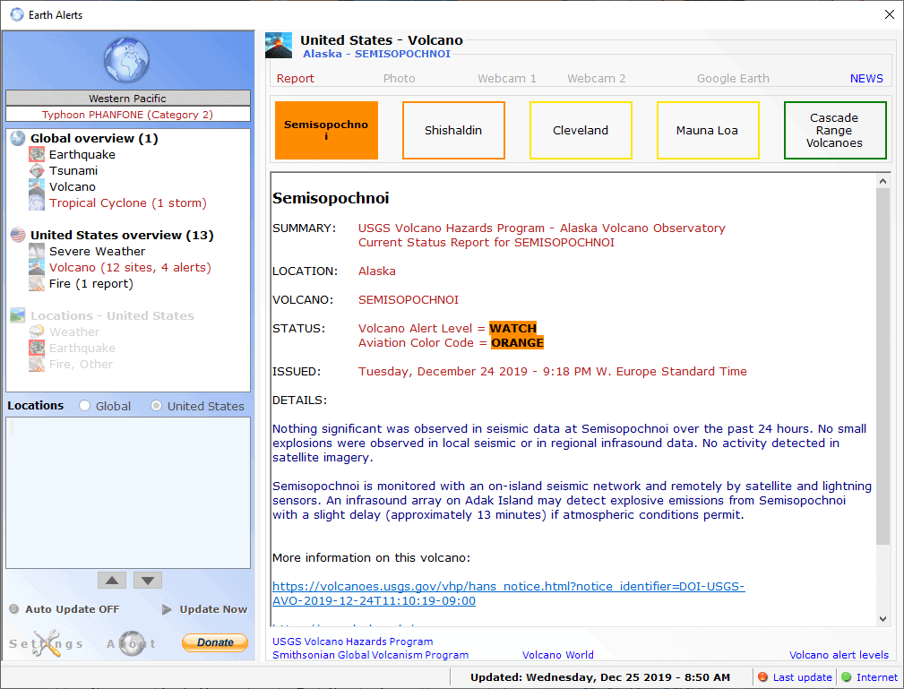
Earth Alerts is a free program for Microsoft Windows devices that monitors severe weather alerts worldwide to inform its users about these in realtime.
The application is compatible with all supported client operating systems (Windows 7 to Windows 10) and requires the Microsoft .NET Framework 4.8.
Earth Alerts displays important information on first run. The program supports global weather alerts and may add specific information about locations in the United States and worldwide to the application; the latter requires a Google Cloud Platform API key and provides you with direct information about thise locations.
It is perfectly fine to use the program without locations support. It may not be as convenient on the other hand as you need to select the alerts under global or United States overview to go through them one by one.
Tip: check out our overview of weather programs for Microsoft Windows systems.
The application displays information about weather alerts in the sidebar. These are sorted into groups and subgroups. The first two groups, Global and United States overview, are always accessible. The group that follows only if you have added an API key.
Groups highlight important events in red and use numbers to indicate the number of alerts. A click on a subcategory, e.g. Volcano, Fire, Tropical Cyclone or Earthquake, provides details.
If multiple alerts are found in a category, data is divided into tabs at the top. The data is color coded to indicate the level of severity, e.g. orange which means it is under watch or yellow which means that it is an advisory.
Information is different depending on the selected alert category. Most categories displays a list of links at the top that you may use to switch between different pages that provide you with information.
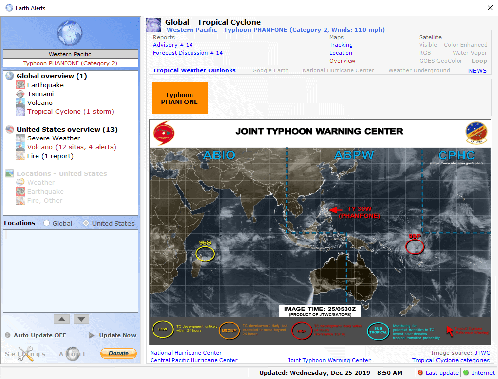
The tropical cyclone page may display a satellite map, provide released advisories and forecasts, or tracking information.
For earthquakes, options to switch between "most recent", "past 24 hours" and "past week" are provided as well as maps and other information. The program links to weather and government sites on the Internet.
The application's settings provide useful information. You may change the auto-update interval or disable auto-updating altogether. The default interval is set to 10 minutes. Other options include switching between metric and and English US measurement systems, or changing notifications.
You may enable or disable certain alert types; if you are not interested in tropical weather alerts, you may disable those for instance. Additionally, you may disable weather alerts for certain regions only and change the minimum magnitude and maximum distance for earthquake alerts.
These options are available for global and United States alerts, as well as global and United States locations (if enabled).
Closing Words
Earth Alerts is a useful software program for Windows, especially so if you face severe weather occasionally or regularly. The program is a bit fiddly when it comes to navigation and the Google Cloud Platform API key requirement for its location feature is not optimal either. If you can look beyond these, however, you are left with a useful weather alerts program for Windows.
Now you: do you use weather apps or programs?







Peter,
This one is even prettier: http://www.meteoearth.com/
Thanks Martin, For bringing this really nice weather application to main attention.
Hopefully you enjoying a ferry pleasant Christmas with the people you love under for you perfect weather conditions. :-)
NOAA mostly. Something on my phone, not sure which one. I think the phone’s in my car, not sure about that either; spent most of the day yesterday skijoring and horse riding in the snow. Christmas card stuff, beautiful, beautiful. Did the Santa thing and I’m not moving until the kids, dogs, cat, horse, lizards, fish, awaken…what a zoo!
Interesting interface for Earth Alerts, looks like an email client.
Merry Christmas and a joyous Holiday Season to all!
The prettiest weather site: https://earth.nullschool.net/
Yes, Peter, that is a nice looking site, new to me.
Here are two sites that I’ve long used, which share some laudable characteristics of the one you linked:
http://hint.fm/wind/ USA only, but at the intersection of dense data and art
https://www.ssec.wisc.edu/data/comp/latest_cmoll.gif
Just to pick out a few other weather sites I use:
USA, to track storms nationwide:
https://radar.weather.gov/Conus/index_lite_loop.php
Satellite imagery from different parts of the spectrum:
https://www.star.nesdis.noaa.gov/GOES/index.php
Holiday destinations world-wide:
https://www.holiday-weather.com/
USA airport delays, and much more data if you explore site:
https://flightaware.com/miserymap/
Aurora forecast if you are heading north:
https://www.gi.alaska.edu/monitors/aurora-forecast
Worldwide ocean buoy data:
https://www.ndbc.noaa.gov/
Global jet stream:
http://www.stormsurfing.com/cgi/display_alt.cgi?a=glob_250
Earthquakes (click on Zoom to World – many settings)
https://earthquake.usgs.gov/earthquakes/map/
Hurricanes, Atlantic and Pacific (out of season at this writing):
https://www.nhc.noaa.gov/
Tsunami map:
https://www.tsunami.gov/
Sometimes I wonder if the Internet is doing too much to make data available to the individual. It’s easy to become overwhelmed, when whelmed is all we need.
Good weather to you, wherever you are…
I only use them on my phone. On my Pixel I use Yandex.Weather and on my Samsung whatever comes by default. Every application should show the same weather results, they all use data from the same weather stations anyway, it only comes down to a widget and UI preference.
Merry Christmas! 🤗