Hidden Google Maps Features Everyone Should Know
Google Maps is one of the most used apps. People use it for directions to just about anything - from the nearest movie theater to a local salon. Google Maps has all the information you need, but did you know there are amazing features within the app? These features make Google Maps more than just a navigation tool. Read on to know some of the best features.
Dressing The Pegman
Everyone knows the Pegman - a little yellow man you can drag around and activate the street level view. However, on a desktop you may see the Pegman dressed. Different areas will see different outfits for the Pegman. For example, when dragging the Pegman over the Loch ness, he becomes a green monster. Pegman’s costume also changes on certain dates.
Back In Time
When you access the street view feature, you can see any street without being present there. However, did you know that you can access the old pictures of the street as well? Google Maps has activated this feature on desktops in 2014 and is enabling it on mobile devices as well.
To see old photos, click the clock icon in the top left. You will see arrows surrounding the clock that runs counter-clockwise. You can scroll through all the previous images for that street.
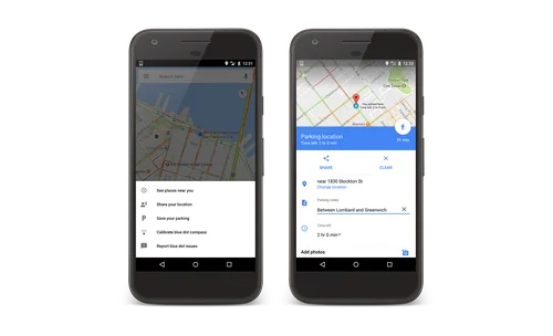
Parking Reminder
Finding your car after parking can be a task. Google Maps can now save you the trouble and help you track where you parked. To do this, open Google Maps when you park. You will see the blue location dot that you need to press and hold. Google Maps will mark your current location with a yellow pin that will be saved for up to 24 hours - unless manually removed.
Creating Maps
Google Maps also allow you to create your maps and place markets for all important places you want to visit. For this, you need to access Google Maps on the desktop and click the three lines next to the search bar on the left. Click on ‘Your Places’, ‘Maps’, and then ‘Create Map.’ You can add markers, directions, and routes. Once created, you can layer these into the Google Maps interface.
Check The Last Train
Google Maps has a lot of public transport information and you can now figure out when is the last time to get home using this mode of transport. You need to start by picking your starting point and your destination. You then need to select public transport at the top of your screen. You will see a ‘depart at’ option. Once you click it, choose the ‘Last’ option and then click on ‘Set.’ Google Maps will then show you the complete list of transport options and different options on how to get there.
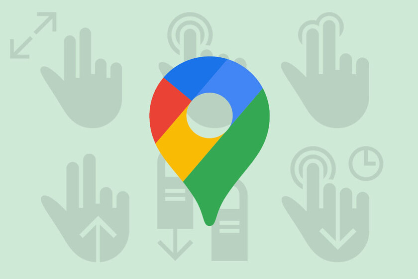
Gesture Control
You no longer need two hands to control your Google Maps app. This comes in handy when you have one hand on the screen. You can now zoom in by double tapping or holding your finger against the screen. Once zoomed in, you can swipe up or down to zoom in or out.
You can change the orientation by pressing your index finger and thumb on the screen and spinning it around. Also, when you swipe up, you can get a bird’s eye view, while swiping down gives you the classic view.
Measure Distance
When going on a trail not covered by Google Maps, you can measure the distance almost instantly. When on a desktop, right-click on any spot and then choose ‘Measure Distance.’ This will be the start point and any click after that will see a straight line drawn toward it. It will then tell you the distance. On a mobile, you need to press and hold on your screen. This will drop a pin. After this, swipe up and choose the ‘Measure Distance’ option. After this, you need to navigate around and press the + button whenever you want to add a stop.
Offline Use
Google Maps automatically downloads your route when you begin. This means you will still have map coverage even if you lose mobile coverage.
AR Directions
The Live View feature in Google Maps allows you to navigate at street level. For this, you need to be in an area that has good street view coverage. You will see the Live View icon in the bottom right. Google Maps will automatically set up the area by scanning the area and helping you get around.
Advertisement