Google Earth's Timelapse feature shows videos of how the planet has changed over 30 years
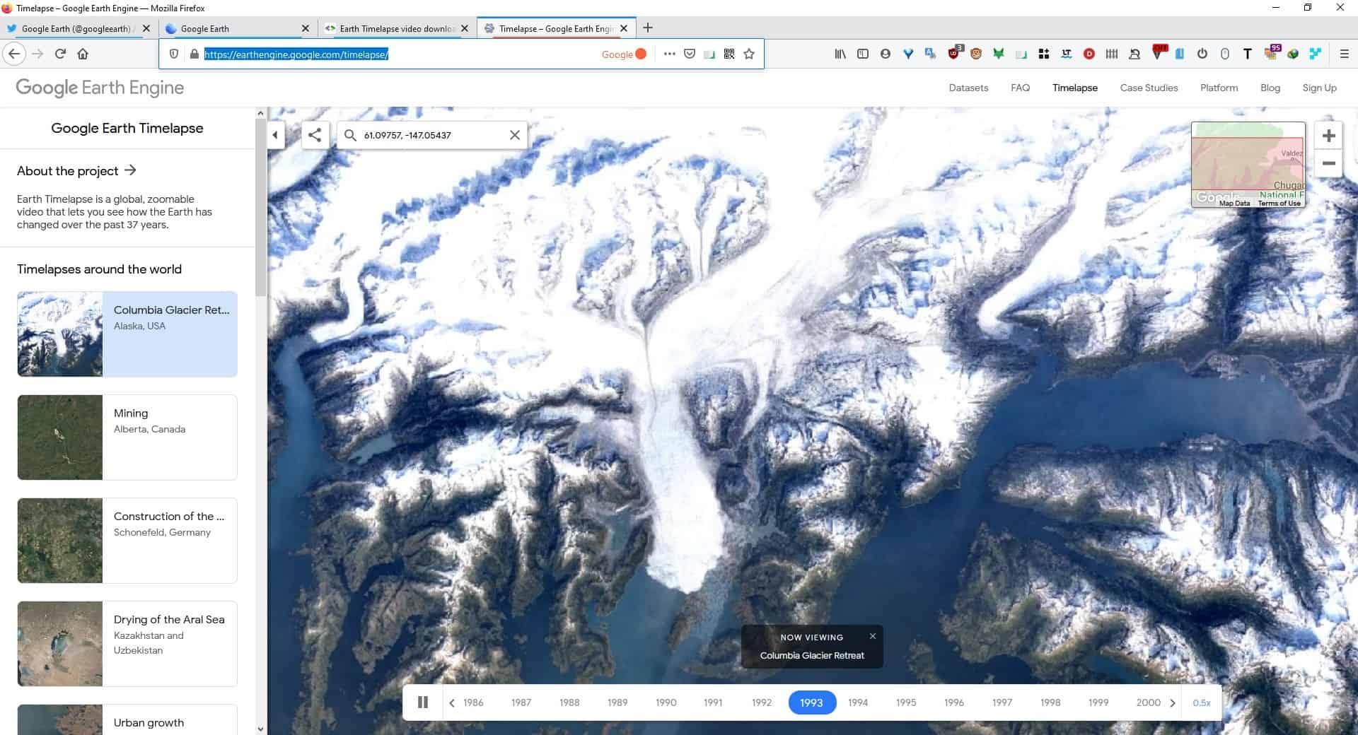
Google has announced a new feature called Timelapse, for its popular satellite imagery service, Google Earth. These stunning visuals show us how our planet has changed over 37 years, due to natural causes, the aftermath of industry and urban expansion, global warming, etc.

So, if you have ever wondered what the world, or your city looked like back in the 1980s, well here's a really cool way to find out.
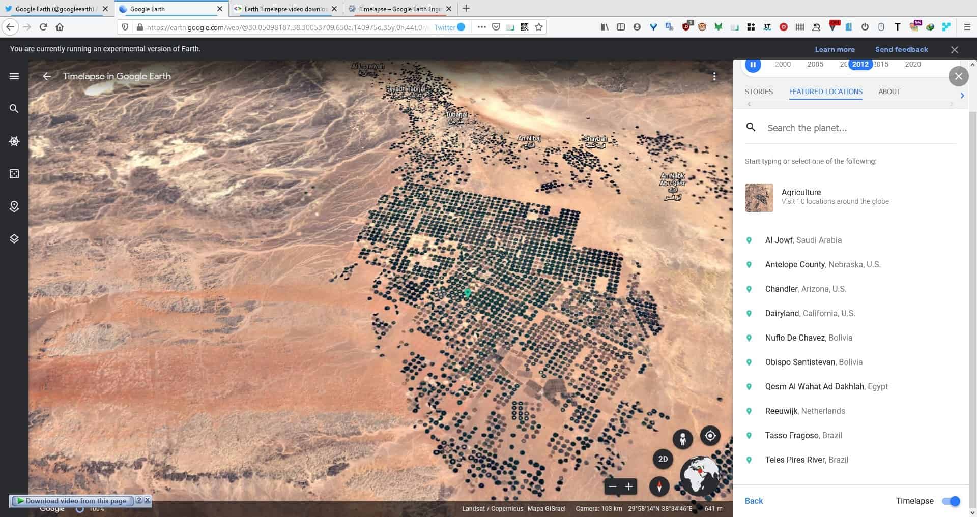
The official Google Earth website lists a few videos, but the Mountain View company shared a link on Twitter that takes us to an experimental section of the site, and that has a lot more Timelapse media. It takes a few seconds to load the page, so don't be surprised if the progress bar stays on the screen for a while. Use the buttons in the bottom right corner to control the view, switch between 3D and 2D, Zoom In and Out.
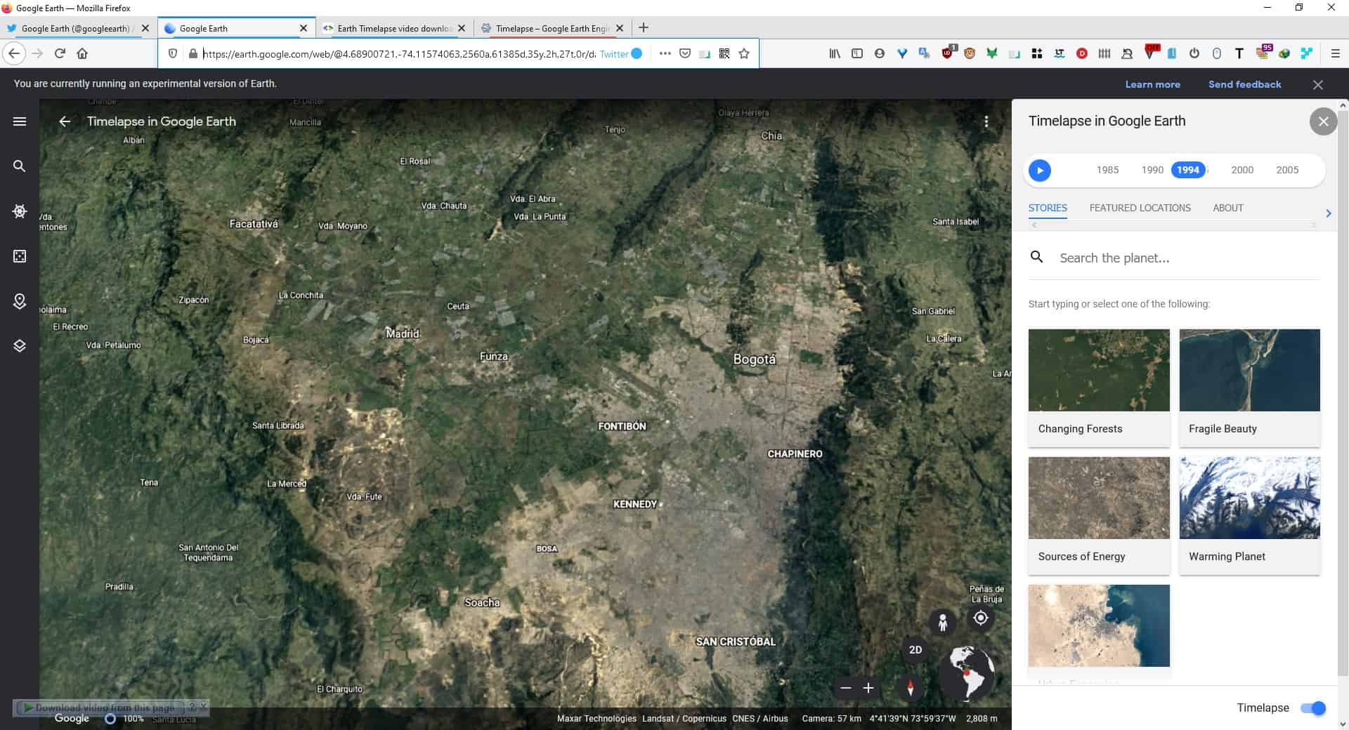
The page has a big sidebar towards the right edge of the screen, which you can use to select the view. There are 5 Stories (categories) that you can choose from; Changing Forests, Fragile Beauty, Sources of Energy, Warming Planet and Urban Expansion.
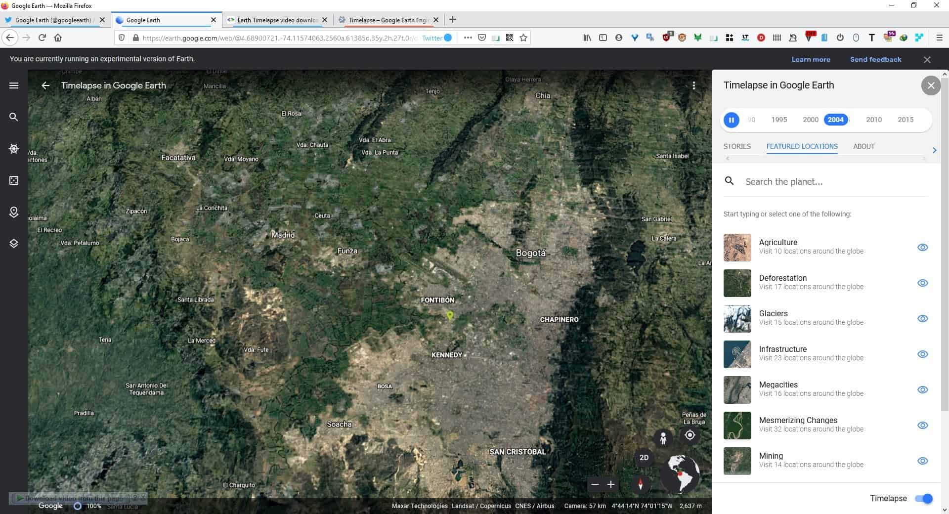
Click on the Featured Locations tab, and it lists different types of content like Agriculture, Deforestation, Glaciers, Infrastructure, Megacities, Mesmerizing Changes, Mining, Natural Disasters, Urban Growth and Waterways. Each one of these has a number of locations listed, which are sort of the most popular ones. But these aren't the only places that you can view on Google Earth Timelapse. You may use the search bar and enter a location's name, sit back and watch the show. Or you can use the globe icon at the bottom, to navigate the map manually.
Hit the pause button at the top of the sidebar. To disable the Timelapse view, click the button in the bottom right-hand corner of the page. Switch to a specific year in the timeline, by clicking on the year number at the top of the panel.
Interestingly, the experimental page does not allow you to control the playback speed, while the official Timelapse page does. The default speed at which the videos are played is 0.5x, but you can change it to 0.25 if you find it too fast, or view it at normal speed. The website keeps resetting the speed to 0.5x, so you'll need to change it manually every time you switch to a different view.
If you are interested in the technical data, you will find the About section useful. Google says that it had to work with over 15 million photos that were taken by 5 satellites, over the course of 30 years. The primary source of the images was US Geological Survey/NASA's Landsat Program. The images were merged with the European Union/European Space Agency's Copernicus Sentinel.
You can view the Timelapse montage in any modern browser including Chrome, Firefox, Edge. But if you are having trouble getting the website to work, check the official Google Earth YouTube channel, which has uploaded a few of the Timelapse videos. The developers page has over 800 videos that you can download.
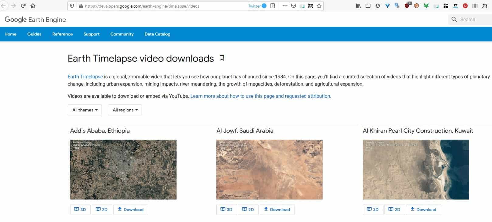
While the content on Google Earth Timelapse looks amazing, the ever-changing landscape of the planet is also a bit alarming.







Humans are devouring the earth and leaving behind pollution and destruction. When we go extinct, we’re taking a lot of life with us.
Not saying many human behaviors aren’t destructive, but there have been 5 mass extinction events on Earth prior to our current era, the worst of them wiping out 98-99% of all life on the planet and yet life finds a way to bounce back. Such devastation dwarfs anything humans have done, unless the climate change “worst-case scenario” is true and carbon levels will eventually spiral so far out of control that Earth’s atmosphere becomes like Venus’, never to recover again.