Map Spreadsheet Locations To Google Maps
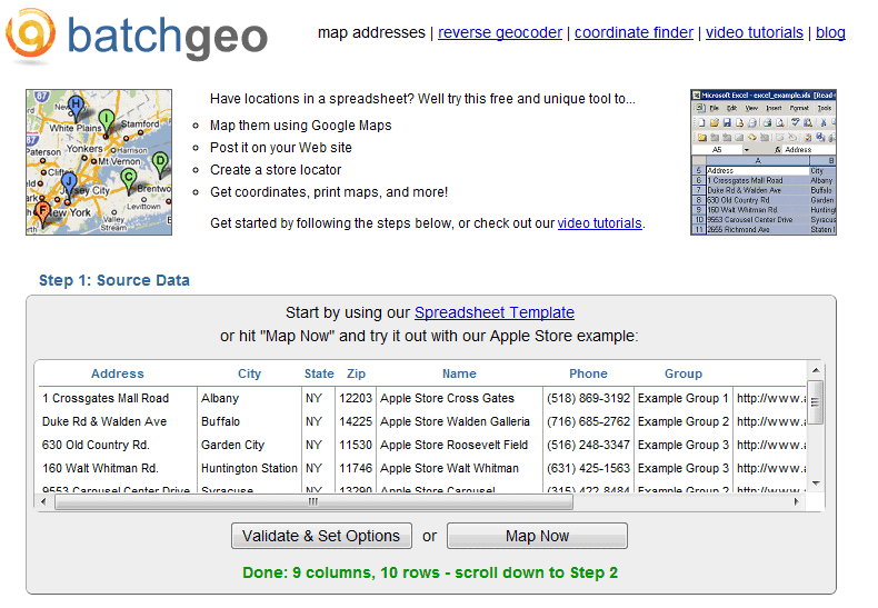
Batchgeo is a free online service that maps spreadsheet locations to Google Maps.
This can be useful for several purposes including creating a store finder, creating a map, calculating distances, house or apartment buying, finding the best route to visit several locations and more.
All that needs to be done to map the locations is to paste the spreadsheet information into the form on the Batchgeo website.
The online service will automatically use the first row as identifier which means that users need to make sure that it contains those.
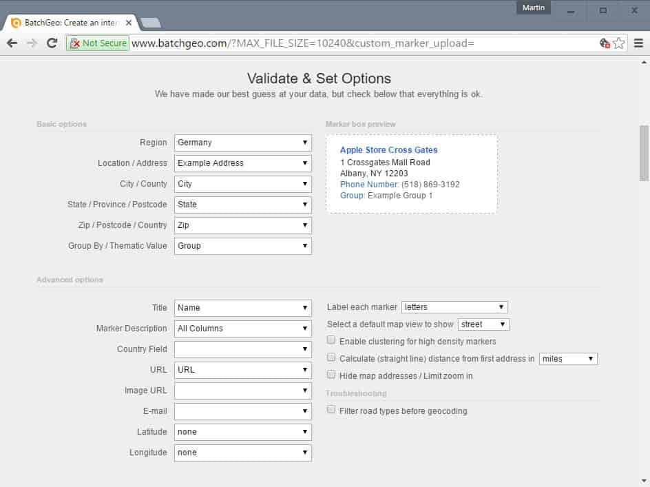
Identifiers such as zip, address or city can be linked to the right columns in case the automatic detection does not do that correctly.
Batchgeo
Batchgeo creates a Google Maps map with the location of the spreadsheet displayed on the map.
It is then possible to save, print and share the map that has been created, download Google Earth KML data, or download the geocoding results again.
All Google Maps view modes are available (map, satellite, hybrid and terrain).
There does not seem to be an option to directly embed the mapped information on a website, only to create a static url on the batchgeo website. The blog mentioned a button to create the embed code but the button is nowhere to be found on the site.
Batchgeo can be a handy program, especially for users who need to create a map from location information stored in a spreadsheet.
Update: The core service is still freely available on the Internet. The developers have added a professional option to their website some time ago, that is offering faster geocoding, password protection, street view integration and pdf support among other features.
The service is ideal for brokers, and people who are looking to buy an apartment or house. It may also be useful for anyone who wants to display a list of locations on a map.
Free users can still use the service directly without registering for an account or signing in to one. All you need to do is paste the spreadsheet data into the form on the main Batchgeo website, and click on the "validate & set options" button afterwards.
This lists the identified fields and provides you with options to correct those that the service may not have identified correctly. You may display advanced options on top of that that list additional data fields and options. This allows you to select the default map view or switch between miles and kilometers. Also, you may change the map style, markers, and colors.
One all that is done, hit the make map button and wait for the data to be analyzed and processed by Batchgeo. A map preview is displayed afterwards that you may use to drag and drop markers to other locations if they are misplaced.
You may publish the map publicly, or keep it unlisted. You do need to provide an email address though for that. This email address is also the key to editing the map at a later point in time.










Thanks. Some folks in marketing would like this.